- LASTROP
- Projects
- Monitorando a restauração da Mata Atlântica a partir do espaço: uma abordagem de integração de dados ...
- Localization
- São Paulo - Brasil
- Start
- junho/2020
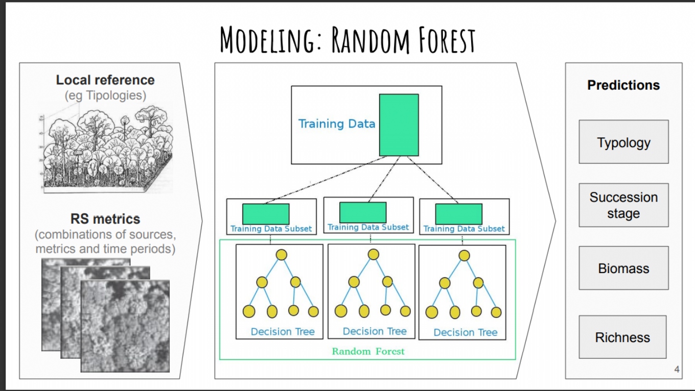
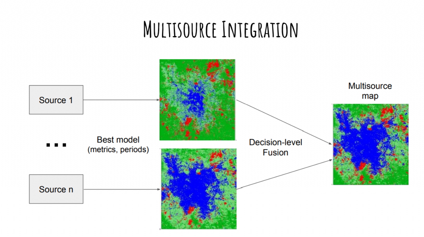
Several landscape restoration projects have been proposed to ensure that forests continue to provide important benefits to people and nature. But forest restoration has historically been implemented as a local activity. Thus, the transition from the plot to the landscape scale brings many challenges to the monitoring of restoration projects. Remote sensing is a great promise to overcome these challenges since sensors onboard satellites allow to monitor forest restoration in a broad scale. Several satellite data are available (e.g. Landsat, Sentinel2, Rapideye and Skysat) with different spatial, spectral and temporal resolutions. Instead of choosing one of these data sources, a strategy that can be used to further improve accuracy is the integration of multiple sources to generate a final product. Thus, the main objective of this study is to evaluate the potential of multisensor orbital data to allow large-scale monitoring of forest restoration in terms of the distinction of forest typologies and successional stages and quantification of forest structure and diversity attributes of the Atlantic Forest for the São Paulo state.